
IL Route 154 from Orange St. to First St.
PROJECT OVERVIEW
About This Project
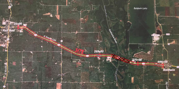
Accurate Group, Inc. (AGI) is an essential subconsultant partnering with Surveying and Mapping, LLC (SAM) on a significant contract dedicated to overseeing multiple Subsurface Utility Engineering (SUE) Phase II projects across Illinois Department of Transportation (IDOT) District Eight. The primary responsibility of AGI within this collaborative effort was to provide comprehensive surveying and ASCE 38-22 compliant SUE services along IL Route 154, stretching from Orange St. to First St. This project holds immense importance in identifying and mapping the underground utility infrastructure to ensure the successful execution of construction activities.
AGI’s team of experts meticulously estimated a total of 150,000 linear feet of utilities within the project corridor. This extensive assessment encompasses a diverse range of utilities critical for the project, including water, electric, gas, and more. By accurately surveying and documenting these utilities, AGI plays a key role in providing essential information vital for the effective planning and implementation of the project along IL Route 154.
Despite the vast scope of the project, AGI remains committed to delivering high-quality services and reliable data. The deliverables for this project were presented in a 2D format, showcasing detailed mapping of the utilities to facilitate efficient reference during the construction phase and ensure accuracy throughout the project lifecycle.
AGI’s involvement as a subconsultant on this project exemplifies their dedication to excellence in Subsurface Utility Engineering. By working collaboratively with SAM and leveraging their expertise, AGI contributes significantly to the success of the project, ultimately supporting the safe and efficient completion of construction activities along IL Route 154. This project underscores AGI’s commitment to providing top-notch SUE services and upholding the highest standards of quality and precision in utility mapping and engineering.
PROJECT IMPACT
Key Outcomes
Mapped 150,000 linear feet of utilities across the IL Route 154 corridor
Delivered detailed 2D utility mapping for efficient construction reference
Supported IDOT District Eight through successful subconsultant collaboration with SAM
Identified critical water, electric, and gas lines within the project corridor
Maintained high-quality, reliable data despite the project's vast scope
Ensured accuracy throughout the project lifecycle via ASCE 38-22 compliance
Supported safe, efficient construction activities from Orange St. to First St.
Upheld the highest standards of quality and precision in utility mapping
Project Information
Client
Illinois Department of Transportation (Sub to SAM)
Location
Randolph County, IL
Project Type
SUE Phase II Quality Level B & Surveying
Completion
SUE Completed 2023