
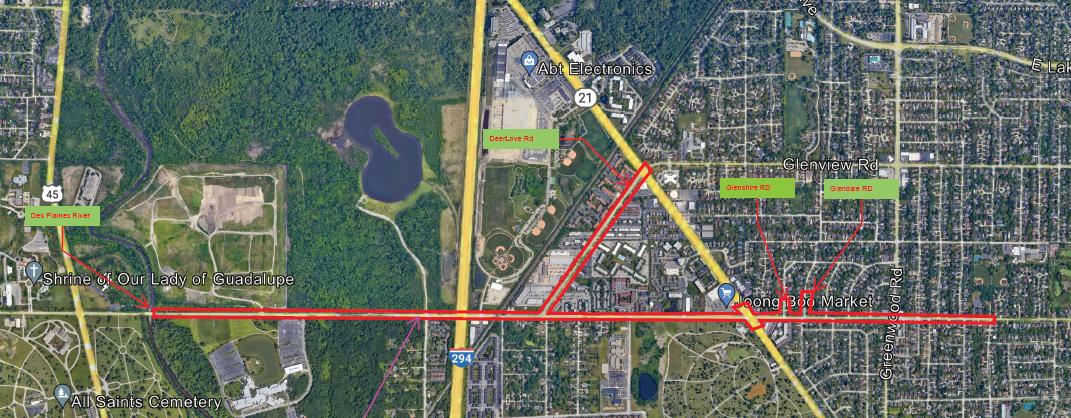
Central Rd., Dearlove Rd. & Surrounding Corridor
PROJECT OVERVIEW
About This Project
Accurate Group, Inc. (AGI) showcased their expertise by delivering a comprehensive suite of survey and Subsurface Utility Engineering (SUE) services, specifically focusing on SUE Quality Level B, to accurately identify the utilities within the project boundaries. The project’s primary goal was to conduct detailed surveying and ASCE 38-22 compliant SUE services for an extensive network of utilities, encompassing electric, water, gas, fiber, CATV, and Force-main Sanitary lines, totaling an impressive 250,000 lineal feet. This in-depth approach was crucial for effectively mapping out the underground utility infrastructure and supporting the successful execution of the project.
AGI’s skilled team meticulously conducted survey and SUE services for the various utilities, adhering to the rigorous standards of SUE Quality Level B to ensure precise and comprehensive identification. By meticulously surveying and documenting the electric, water, gas, fiber, CATV, and Force-main Sanitary lines, AGI provided essential information critical for efficient project planning and execution.
Despite the substantial scale of the project involving a vast network of utilities, AGI’s commitment to accuracy and excellence remained unwavering. The deliverables for this project were presented in a 2D format, offering detailed mapping of the utilities for reference during the construction phase. While 3D deliverables provide enhanced visualization, the utilization of 2D formats does not compromise the quality of the information provided, ensuring effective communication and decision-making throughout the project lifecycle.
AGI’s dedication to providing SUE services at Quality Level B demonstrates their commitment to delivering top-notch utility mapping and engineering solutions. By delivering reliable and precise data for a significant network of utilities, AGI played a crucial role in supporting the success of the project. This project exemplifies AGI’s proficiency in utility mapping services, highlighting their expertise and dedication to delivering high-quality solutions in the field of subsurface utility engineering.
PROJECT IMPACT
Key Outcomes
Mapped an impressive 250,000 linear feet of utilities across the corridor
Delivered detailed 2D mapping spanning five connected roadway segments
Identified Force-main Sanitary and CATV lines critical to the corridor
Maintained rigorous SUE Quality Level B standards across a vast utility network
Supported efficient planning across Central Rd., Dearlove Rd., and connecting streets
Ensured effective communication and decision-making throughout the project lifecycle
Upheld accuracy and excellence despite the project's substantial scale
Demonstrated AGI's proficiency in large-scale utility mapping services
Project Information
Client
Illinois Department of Transportation
Location
Cook County, IL
Project Type
SUE Quality Level B & Surveying
Completion
SUE Completed 2025