
MWRDGC: Survey for Final Design for a Flood Control Project
PROJECT OVERVIEW
About This Project
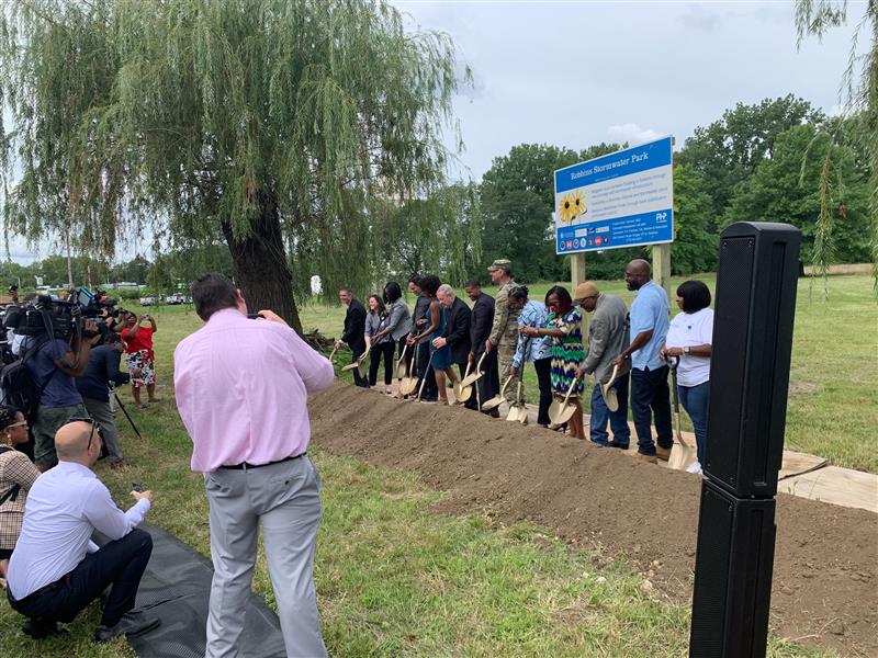
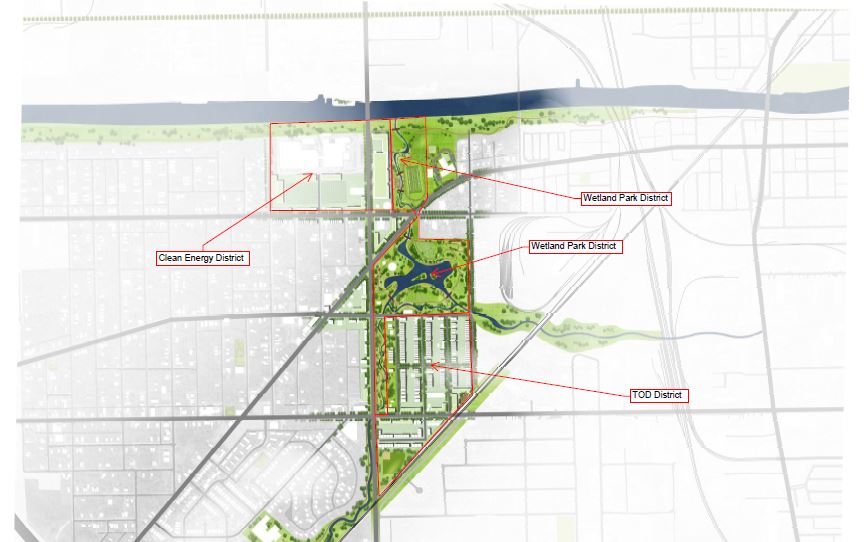
Accurate Group, Inc. (AGI), serving as a subconsultant to Donohue & Associates, played a key role in the Robbins, IL Flood Control Project. AGI’s responsibilities were centered around the critical task of conducting a comprehensive topographic and utility location survey, essential for the project’s design and implementation. Their work laid the groundwork for a flood mitigation system designed to protect the local community from flooding risks, ensuring the proper placement and alignment of new infrastructure.
AGI’s scope of work included the preparation of detailed base files that incorporated vital parcel information regarding property ownership and easements within the project area. These base files were crucial for identifying potential property conflicts and ensuring that all work adhered to regulatory and land use requirements.
The specific tasks carried out by AGI as part of this project included:
- Horizontal & Vertical Control Tie to State Plane Coordinates: AGI established accurate horizontal and vertical control points tied to the Illinois State Plane Coordinate System. This provided a consistent reference framework for all subsequent design and construction activities, ensuring precision in the placement of flood control features.
- Topographic Survey (25-foot Grid Ground Shots): AGI conducted detailed topographic surveys using 25-foot grid intervals to capture the surface elevations and contours across the project site. This data was essential for understanding the terrain and planning drainage systems.
- Topographic Survey of Existing Buildings: AGI mapped the location and footprint of existing buildings within the project area to ensure that new infrastructure would be designed in harmony with the existing built environment, preventing any disruptions to nearby structures.
- Utility Survey (including Pipe and Culvert Survey): AGI carried out a comprehensive utility survey to identify the locations and depths of existing utilities, including pipe culverts, which were critical for understanding how the new flood control systems would interact with existing infrastructure. This also helped to avoid conflicts during construction.
- Box Culvert and Bridge Survey over 135th Street: AGI performed a detailed survey of the existing box culverts and bridge structures over 135th Street. This survey helped to assess the condition and dimensions of these structures to ensure their compatibility with the flood control design and improvements.
- Topographic Surveys along Key Roadways: AGI executed topographic surveys along several critical roadways in the project area, including Kedzie Avenue, 139th, 137th, 135th Streets, and Clair Blvd. These surveys were essential for assessing road elevations and drainage patterns, and ensuring that flood control measures would not adversely impact the road infrastructure.
- Tree Survey: AGI performed a tree survey to document the location and size of trees within the project site. All trees with a trunk diameter of six inches or larger were recorded. This information was crucial for environmental considerations, including the preservation or removal of trees during construction.
- Creek Cross Section Survey (25-foot intervals over 1330 feet): AGI conducted a cross-sectional survey of the creek running through the project site at 25-foot intervals, covering a total distance of 1,330 feet. This detailed survey provided critical data for designing the flood control system and ensuring effective water flow management.
- QA Survey: AGI performed a quality assurance survey to verify the accuracy of the collected data, ensuring that all measurements met the high standards required for flood control projects.
- Processing Survey Data and Submittals: After completing the fieldwork, AGI processed the collected survey data and prepared detailed submittals for the design team. These submittals included all relevant survey information, such as topography, utility locations, property details, and environmental features, which were crucial for the project’s design phase.
Through their comprehensive surveying efforts, AGI provided the foundational data necessary to design an effective and sustainable flood control system for Robbins, IL. Their work ensured that the project design would be both precise and efficient, addressing the community’s flood risks while minimizing the impact on existing infrastructure and the environment.
PROJECT IMPACT
Key Outcomes
Delivered comprehensive topographic and utility surveys for flood control design
Established horizontal and vertical control tied to State Plane Coordinates
Conducted a 1,330-foot creek cross-section survey at 25-foot intervals
Surveyed box culverts and bridge structures over 135th Street
Documented trees and existing buildings supporting environmental planning
Mapped utilities across key roadways minimizing construction conflicts
Performed quality assurance surveys ensuring high data accuracy
Provided the foundational data for an effective, sustainable flood control system
Project Information
Client
Metropolitan Water Reclamation District of Greater Chicago (Sub to Donohue & Associates)
Location
Robbins, IL
Project Type
Topographic & Utility Survey for Flood Control Design
Completion
Survey Completed 2020