
IL Route 31 at Chicago St. and Highland Ave. Phase I Survey
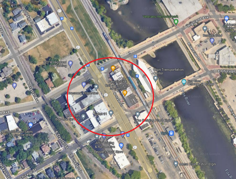
PROJECT OVERVIEW
About This Project
Accurate Group, Inc. (AGI) provided critical surveying services as a subconsultant to Primera Engineers, conducting a detailed topographic and legal boundary survey for this high-profile infrastructure project. AGI’s comprehensive approach ensured that all necessary data was collected with precision, supporting the design and construction teams with reliable information for project planning and execution. Their work involved a series of complex tasks, from setting control points to integrating utility data, ensuring a seamless process from initial survey to quality assurance.
Scope of AGI’s Services:
- Control Points and Benchmarks: AGI set precise control points and benchmarks across the project site to establish a reliable framework for all survey activities. These benchmarks provided reference points for horizontal and vertical control, ensuring accuracy throughout the survey process. These control points served as the foundation for subsequent measurements, offering consistency for the entire project’s alignment and layout.
- Field Alignment Establishment: AGI established key alignments in the field, ensuring that all design elements, including roadways, pathways, and utilities, were correctly positioned according to the engineering plans. This process involved precise measurements and the use of advanced surveying equipment to ensure that each element was aligned within the specified tolerances.
- Right-of-Way (ROW) Establishment: A crucial part of the survey involved establishing the right-of-way (ROW), marking the legal boundaries between public and private property. AGI’s ROW establishment ensured that all project elements were located within the legally defined public space, avoiding potential conflicts with private properties and ensuring compliance with municipal regulations.
- Topographic Data Collection: AGI collected detailed topographic data, including critical measurements of structures and pipes. This data included measure downs, pipe sizes, and rim inverts for all underground infrastructure, ensuring a clear understanding of the existing utilities and drainage systems. Additionally, each structure and pipe were documented with point numbers, stationing, and offsets recorded in field books, providing an organized and accessible record of all collected data.
- Full Cross Sections Every 100 Feet: AGI performed comprehensive cross-sectional surveys at 100-foot intervals along the project corridor. These cross sections extended a minimum of 15 feet beyond the ROW, ensuring coverage of adjacent areas such as cross-streets and driveways. This detailed survey data provided an accurate profile of the terrain and existing infrastructure, allowing engineers to design effectively for the site’s conditions.
- Tree Location and Size Survey: To assess potential environmental impacts and guide the planning process, AGI conducted a tree survey to document the location and size of trees within the project area. This information was used to determine whether trees needed to be preserved, removed, or protected during construction, aligning the project with local environmental guidelines.
- Railroad Survey: AGI conducted a specialized railroad survey, capturing critical data related to railroad crossings, track alignments, and nearby infrastructure. Given the complexities of working near railroads, AGI’s precise measurements ensured that any design or construction activities complied with railroad regulations and safety standards.
- Sign Survey Logs: As part of the roadway and traffic management planning, AGI performed a sign survey, documenting the location, condition, and specifications of existing signs within the project area. These logs were essential for planning traffic control measures, ensuring that signage was updated or replaced as needed for the project.
- Utility Plan Integration: AGI integrated existing utility plans into the topographic survey to provide a comprehensive understanding of underground and overhead utilities within the project limits. This integration ensured that the design accounted for existing infrastructure, preventing conflicts during construction and allowing for more efficient planning of utility relocations or modifications.
- Quality Assurance/Quality Control (QA/QC) in the Field: Throughout the surveying process, AGI implemented rigorous QA/QC procedures to ensure the accuracy and reliability of the data collected. Field checks and data verification processes were conducted at each stage to maintain the highest standards of quality. This attention to detail ensured that the topographic and boundary data was consistent, precise, and ready for use in the engineering and design phases.
Impact of AGI’s Services on the Project:
AGI’s contributions were essential to the success of the project, as their precise survey data provided the foundation for the engineering design and construction efforts. By accurately setting control points and establishing the ROW, AGI ensured that the project adhered to legal boundaries and that all design elements were placed correctly. Their comprehensive topographic and boundary survey offered a clear understanding of the existing site conditions, including critical infrastructure such as drainage systems, utilities, and railroad tracks.
The detailed data collection on structures, cross sections, and environmental features such as trees allowed engineers and planners to make informed decisions about design adjustments, environmental protection measures, and construction methods. Additionally, the integration of utility plans and meticulous QA/QC processes helped prevent costly errors and rework, streamlining the project’s progress and minimizing delays.
Summary:
AGI’s expertise in topographic and legal boundary surveys was instrumental in supporting Primera Engineers in delivering a successful infrastructure project. From setting control points and establishing field alignments to performing detailed topographic data collection and railroad surveys; AGI provided precise, reliable data that was crucial for informed decision-making and efficient project execution. Their commitment to quality assurance and attention to detail ensured that the project was built on a solid foundation of accuracy and compliance, contributing to its overall success.
PROJECT IMPACT
Key Outcomes
Delivered detailed topographic and legal boundary survey data
Established control points and field alignments ensuring design accuracy
Determined right-of-way boundaries avoiding conflicts with private property
Performed full cross sections every 100 feet along the project corridor
Conducted a specialized railroad survey ensuring safety compliance
Documented trees and existing signage supporting planning decisions
Integrated utility plans preventing conflicts during construction
Supported Primera Engineers with precise, reliable data for project execution
Project Information
Client
Illinois Department of Transportation (Sub to Primera Engineers)
Location
Elgin, IL
Project Type
Phase I Topographic & Legal Boundary Survey
Completion
Survey Completed 2026